


Global Mapper Mobile app for iPhone and iPad
Developer: Blue Marble Geographics
First release : 15 Jun 2016
App size: 119.08 Mb
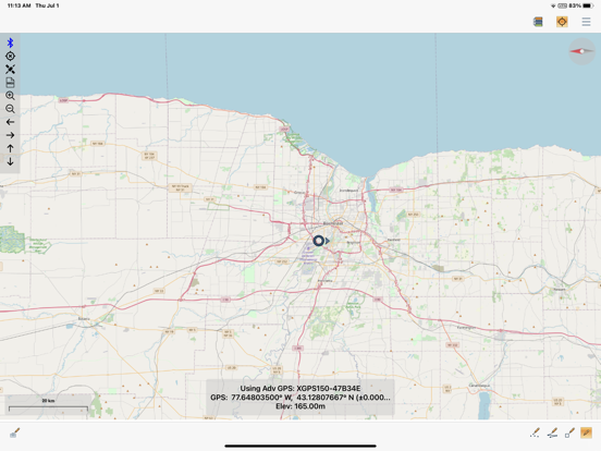
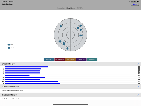
All the maps you need, in the palm of your hand. Global Mapper Mobile is a powerful GIS data viewing and field data collection application that utilizes your iOS device’s GPS capability to provide situational awareness and location intelligence for remote mapping projects.
Highlights:
-Provides field access to all of your GIS data
-Offers straightforward, GPS-based field data collection
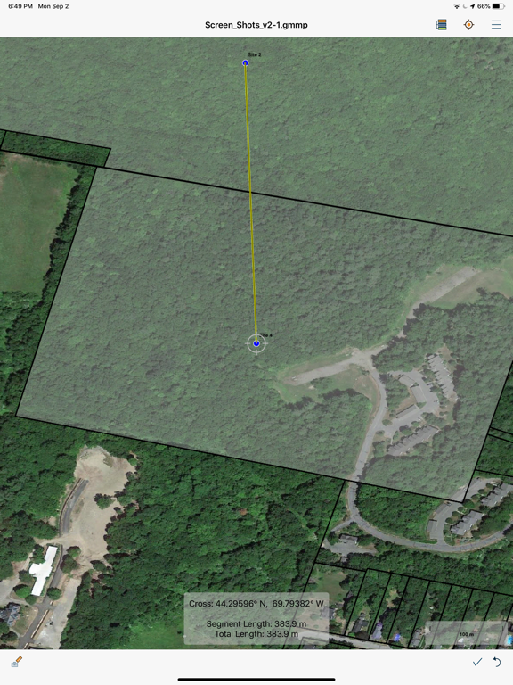
-Includes an array of digitizing or drawing tools
-Enables the assignment of attribute data
-Allows simple and efficient data deployment and return
-Uses self-contained map storage and display – No data connection required
Used in conjunction with the desktop version of Global Mapper, Global Mapper Mobile is capable of displaying over 200 formats of raster and vector spatial data without the need for a continual data connection. Data is transferred to the device via iTunes or email in the form of Global Mapper Mobile Package Files that efficiently compress multiple layers into a single file and allow large amounts of data to be stored and displayed.
On-device data collection is made simple and efficient with preconfigured collection parameters assigned using templates to the target layer before transferring the file from the desktop version of Global Mapper to the device. This ensures consistency and accuracy through the use of pick lists, required entries, etc.
Beyond simply creating waypoints or track files, Global Mapper Mobile offers a full suite of digitizing tools for manually drawing lines, points, and polygons and for managing the attributes associated with these features. There is even an option to assign a photograph to a collected point and this association is retained when the field collected data is uploaded to the desktop software.
Note: Continued use of GPS running in the background can dramatically decrease battery life.
The transfer of data to and from the application is effectively handled using the File Sharing function in iTunes or via email. Using these simple procedures, Global Mapper Mobile Package (GMMP) files can be deployed to one or more compatible devices. On returning from the field, the modified files are quickly upload into the desktop version of Global Mapper from where the data can be merged, edited, analyzed, and, if necessary, exported in one of dozens of supported formats or written into a spatial database.